LISBON
Improve citizens’ quality of life and promoting new tourist routes
Lisbon, the capital of Portugal, boasts a population of approximately 546,000 inhabitants within its 100 km2, divided into 24 parishes. The city’s investment in Sustainable Tourism has led to a rethinking of existing attractions, leveraging its strategic location, historical-cultural points, favourable climate, and renowned hospitality. This includes enhancements in urban art, green and blue infrastructures, natural heritage, landscape, and more. Among other awards, Lisbon was named Europe’s Leading City Destination 2024 by the World Travel Awards.
As one of the 100 Mission Cities committed to being climate-neutral and intelligent by 2030, Lisbon has its Climate City Contract approved and serves as a mentor city in implementing solutions to reinforce sustainable tourism destinations. Through the Cool Noons project, Lisbon aims to align strategies that promote new tourist attractions in less popular areas, ensuring these new attractions are certified by the city. This initiative not only seeks to improve residents’ quality of life but also to foster new behaviours for a healthier, more resilient, sustainable, shared, and inclusive future. By integrating these sustainable practices and promoting lesser-known attractions, Lisbon is not only enhancing the tourist experience but also ensuring that tourism benefits the local community economically, socially, and environmentally.
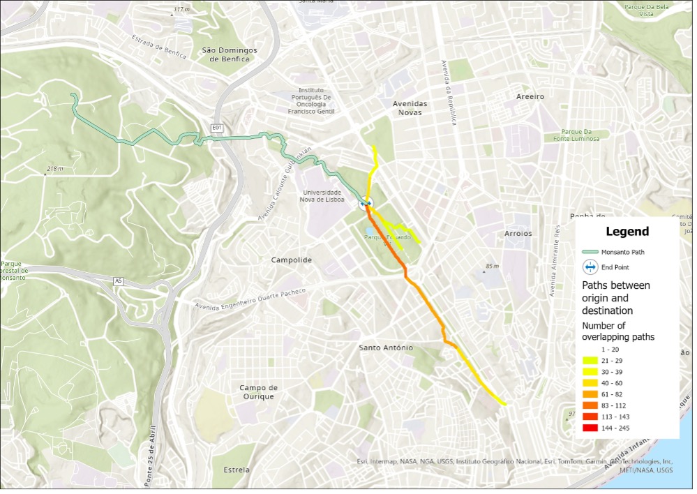
The Cool Noons Paths initiative in Lisbon was designed in line with the city’s policies and strategies and was developed following an internal focus group within the municipality. The general methodology was applied after the focus group, specifically to identify the Least Cost Paths between tourist origins (e.g., hotels) and the routes to be promoted. An Optimal Regional Connectivity approach was also applied by incorporating previously identified points of interest along the proposed paths. This approach helped identify variants to the proposed Cool Noons paths, which were discussed with stakeholders in dedicated workshops. During these workshops, the paths were detailed, and new interventions emerged. Workshop participants were responsible for selecting the final paths, considering path variations with cooler alternatives, or proposing interventions in initially suggested areas to reduce temperatures along those segments.
Path 1
Alvalade
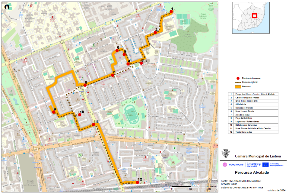
The Alvalade Cool Noons Path was designed to offer an authentic experience of life in a modern and traditional neighbourhood, with a clear focus on sustainability. The route allows visitors to immerse themselves in the daily routines of locals, understanding the characteristics and peculiarities of the local culture outside the more touristy and densely populated areas of the city. It is an opportunity to observe the coexistence of different generations in the same public space, feel the heartbeat of neighbourhood life, and enjoy a diverse local commerce that ranges from traditional to modern, including art galleries, good restaurants, green areas, and architectural and heritage elements of interest.
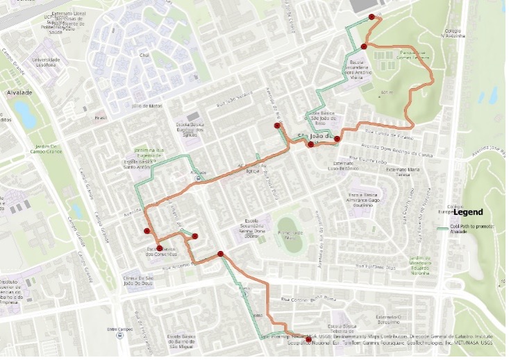
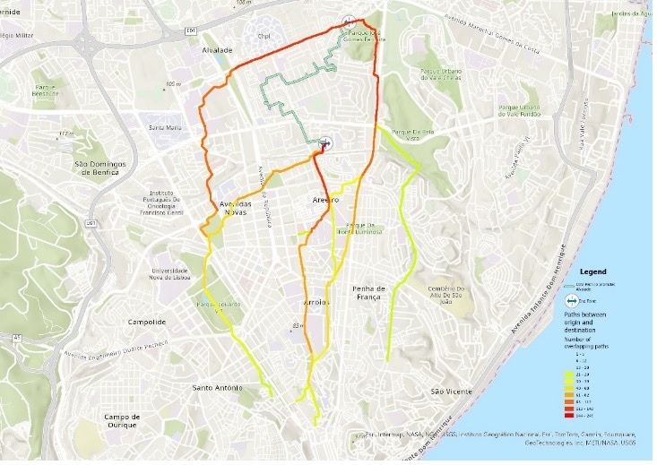
This route is part of Lisbon’s sustainable itinerary, promoting responsible tourism practices that benefit both visitors and residents:
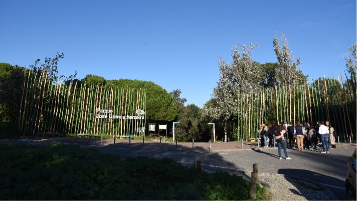
1. José Gomes Ferreira Park: A public green space designed by architect Gonçalo Ribeiro Teles, with free access, covers about 11 hectares and offers a diverse range of fauna and flora, as well as various types of facilities: two picnic areas (with tables and drinking fountains), a children’s playground, a fitness circuit, leisure spaces, and a kiosk with a terrace.
This green space is a structuring element of the entire neighbourhood, and plays an important role in preserving biodiversity, climate regulation, sustainability, and the quality of life for the residents and visitors of Alvalade. Coordinates: 38.759017, -9.135182
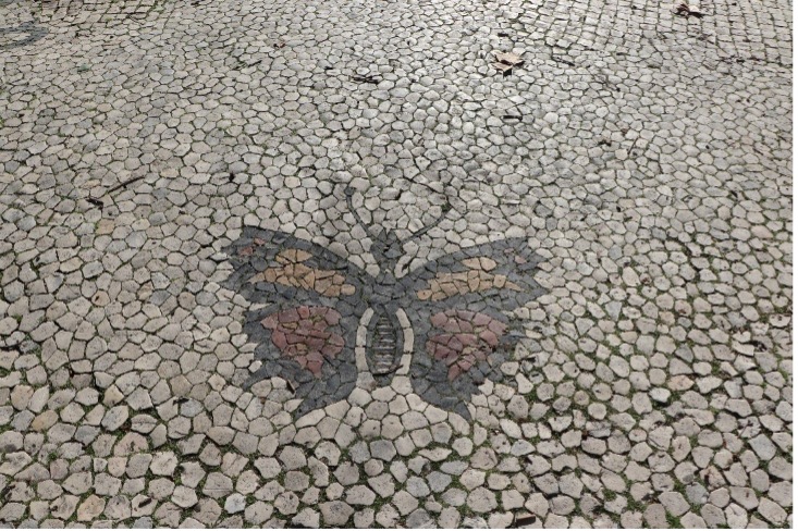
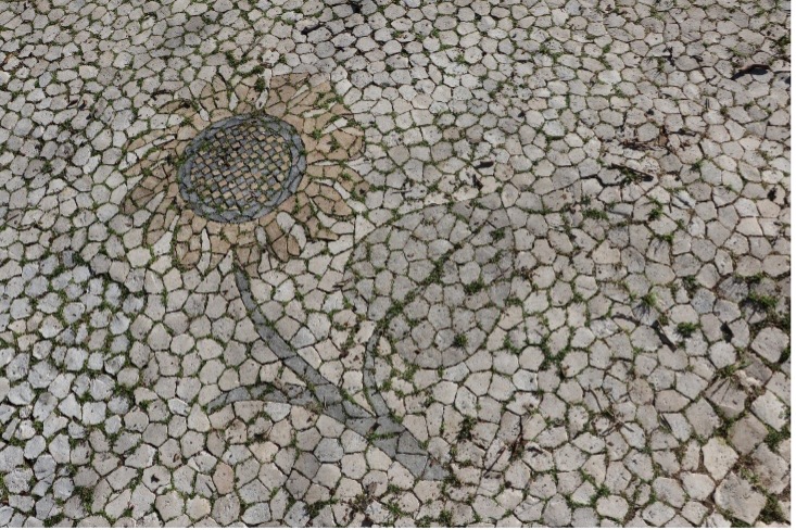
2. Portuguese Pavement: Along approximately 100 meters of the route, colourful decorative elements can be observed in the Portuguese pavement (tulips, butterflies, geraniums, sunflowers), a public space covering art, particularly for sidewalks, very typical in the city. This pavement, dating approximately from 1956, illustrates the importance of biodiversity. The area is covered by large trees, enhancing its natural beauty. The rarity of this authentic work of art, one of the only polychromatic examples in Lisbon, deserves preservation and maintenance with the same care and dedication with which it was conceived. Coordinates: 38.756395, -9.137763
3. São João de Brito Church: The façade of the church has a gable shape, with a central window featuring diamond-shaped glass panes. There is a statue of São João de Brito and the arms of the Cardinal Patriarch of Lisbon above it. At the top of the façade, there is an iron cross approximately 5 meters high. The interior of the church has a Latin cross layout with a single nave, and the ceiling is a barrel vault. The church is naturally cool, providing a comfortable environment for visitors. Like other collective facilities and services in the neighbourhood, it is an important and structuring element of the neighbourhood’s life. Coordinates: 38.755013, -9.138226
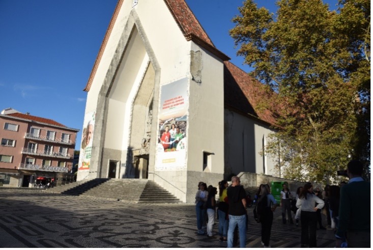
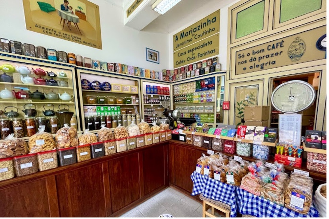
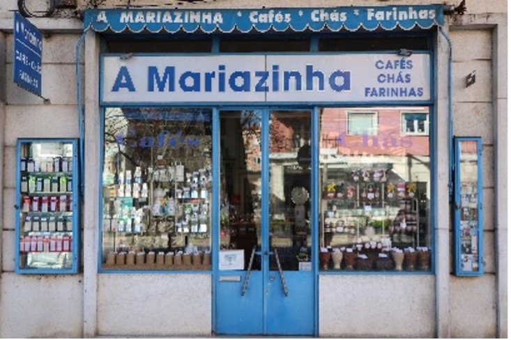
4. The Mariazinha (Shops with History): The coffee and tea shop located at Avenida do Rio de Janeiro, 25B, has been open since 1934 and is one of the historic traditional commerce shops in the neighbourhood. It is part of the Municipality’s “Shops with History” program, which aims to preserve these establishments and their material, historical, and cultural heritage, as well as to promote and revitalize local and traditional commercial activities. Coordinates: 38.755171, -9.139314
5. Alvalade Market: This is another central facility of the neighbourhood. It spans about 3,000 square meters and has 219 sales spots (for vegetables, fruit, meat, fish, eggs, and flowers), remaining a reference today for the quality of its products. It frequently hosts organic product fairs, workshops, activities, and awareness campaigns related to healthy living and eating, resource preservation, and sustainability. There is a photovoltaic plant installed on the roof that helps reduce energy costs, and the building is air-conditioned. Coordinates: 38.755733, -9.139704

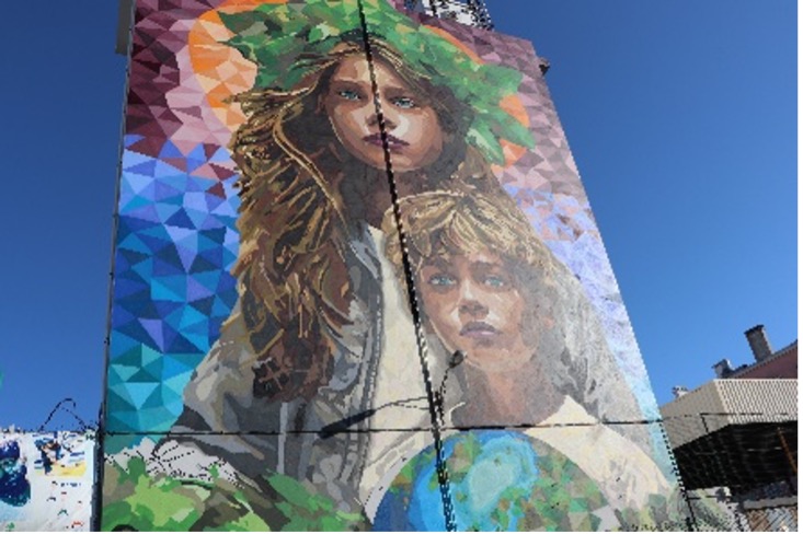
6. “Earth Hour” Urban Street Art Mural: The initiative within the scope of ‘Earth Hour’ 2024 involved community participation in a collective painting, developed as part of a partnership between the Lisbon City Council, the Alvalade Parish Council, and the Worldwide Fund for Nature (WWF). The mural tried to convey a familiar message “They could be two siblings, two cousins, whatever. They are family. And this family is questioning what the future of their home will be. The home, in this case, is our planet. The message conveyed is that we should treat the planet as if it were our own home”. Coordinates: 38.755487, -9.141079
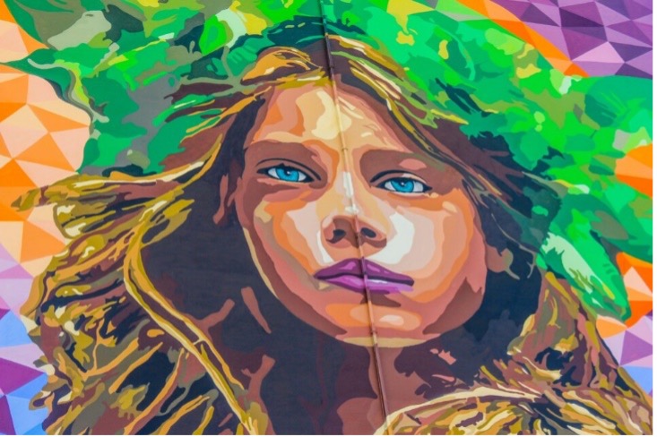
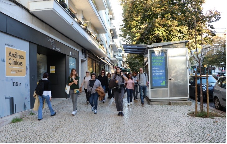
7. Igreja Avenue: The main commercial avenue of the neighbourhood is vibrant and dynamic, bustling with activity from various generations of city inhabitants. On both sides of the street, Linden trees (Tilia), known for their broad, voluminous canopies and aromatic flowers, are prominently featured. These alignment trees provide essential shading on hot days, playing a significant role in climate regulation and thermal comfort in public spaces. Coordinates: 38.753967, -9.141429
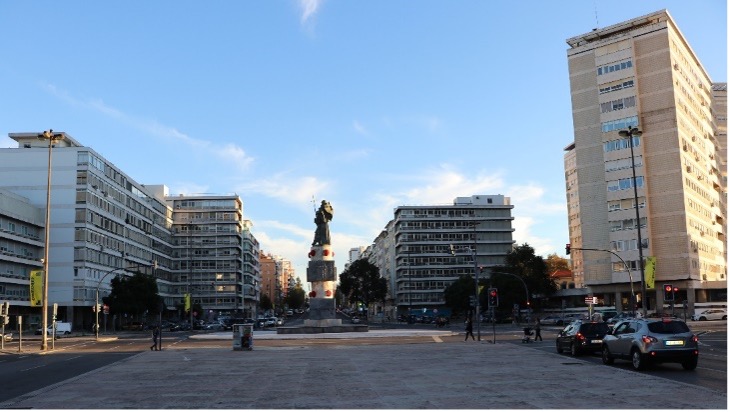
8. Alvalade Square: The central part of the square is occupied by the Monument to Saint Anthony, one of the patron saints of Lisbon. Standing at a total height of 12 meters and weighing 78 tons, this work was executed between 1970 and 1972 by architect Carlos Antero Ferreira and sculptor António Duarte, the father of Filipe Duarte Santos. This convergence of streets features several climate-controlled points of interest, including neighbourhood-style shopping centres, street restaurants, and a local cinema. Coordinates: 38.753261, -9.144333
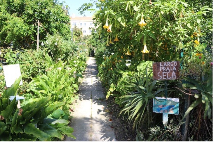
9. Community and urban gardens: The spaces between blocks form green, permeable pockets that enhance water infiltration into the soil, creating cooler microclimates. These areas offer leisure and recreation spots, fostering social interaction and strengthening neighbourhood bonds. Many of these spaces have been developed and maintained by residents, evolving into small gardens and urban farms—true oases amidst the urban landscape. They serve as refreshing spots and provide ideal opportunities for rest and relaxation. Coordinates: 38.751136, -9.146660
10. The Coruchéus Studios and Library: Inserted in an original and unique complex that integrates 50 studios for artists, the Quadrum Gallery, a library, and other public-use spaces, the Coruchéus Studios are dedicated to the promotion and development of artistic activity in the city of Lisbon. The Coruchéus Library is housed in a historic mansion dating back to the 18th century, formerly known as the Quinta dos Coruchéus. Currently, both cultural facilities are surrounded by large trees, an esplanade, a garden, an urban street art mural, and other shaded and pleasant areas to stay. Coordinates: 38.750805, -9.144583
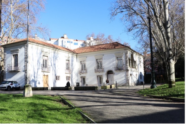
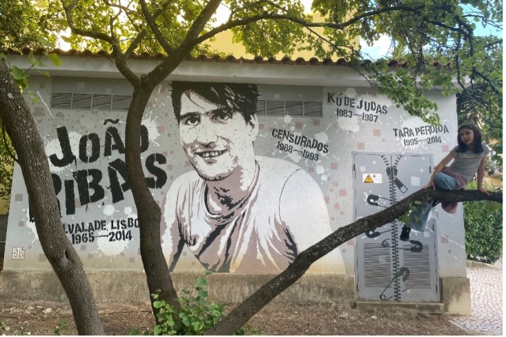
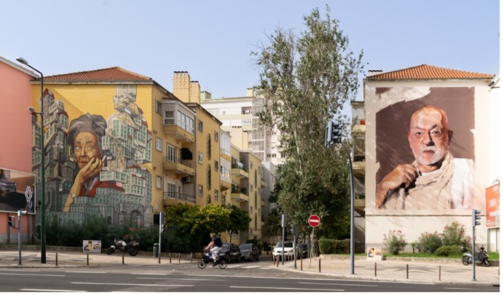
11. Galería dos Inesquecíveis (Gallery of the Unforgettable one’s project): is an initiative by the Lisbon Alvalade parish, aiming to honour prominent Portuguese artists through the creation of urban art street art murals. This project seeks to celebrate the culture and history of Portugal, highlighting iconic figures and their contributions in various artistic fields. Coordinates: 38.750324, -9.142631
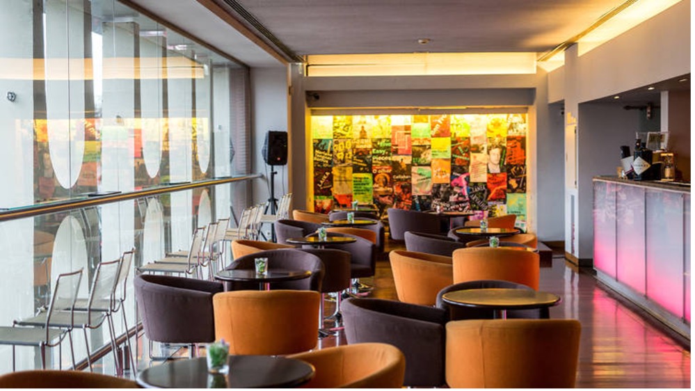
12. Teatro Maria Matos (Maria Matos theatre): Inaugurated on October 22, 1969, Teatro Maria Matos underwent significant renovations starting in August 2004. The project included the refurbishment of the auditorium and backstage, improvements in acoustics, lighting, climate control, security, and the removal of architectural barriers. The theatre’s cool interior offers a break from the heat while appreciating its historical and architectural values or attending a cultural event. Coordinates: 38.745902, -9.138660
Path 2
Monsanto
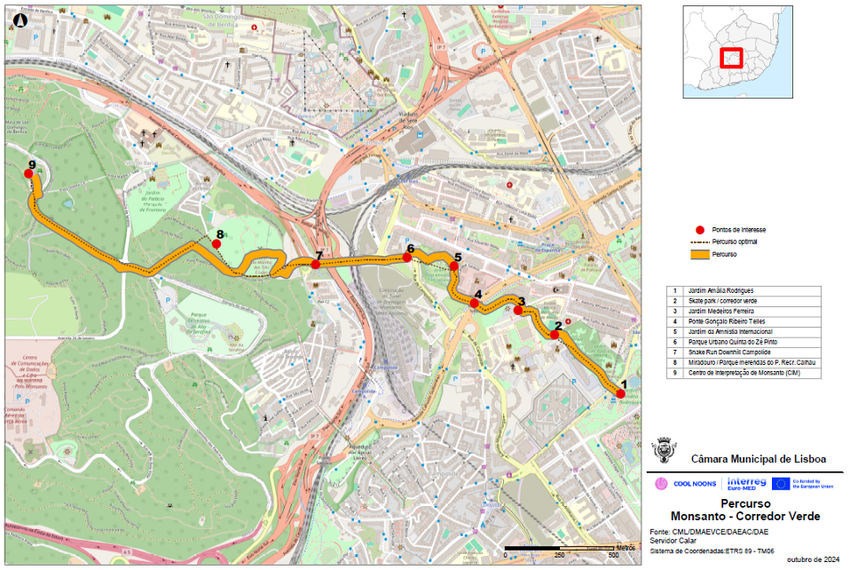
The Monsanto Cool Noons Paths was designed to offer an immersive experience of the city’s natural and cultural heritage along a tranquil green corridor, with a clear commitment to sustainability.
This route guides visitors from the historic city center to Monsanto Forest Park through parks, gardens, viewpoints, and cultural landmarks, showcasing how urban nature and local life coexist.
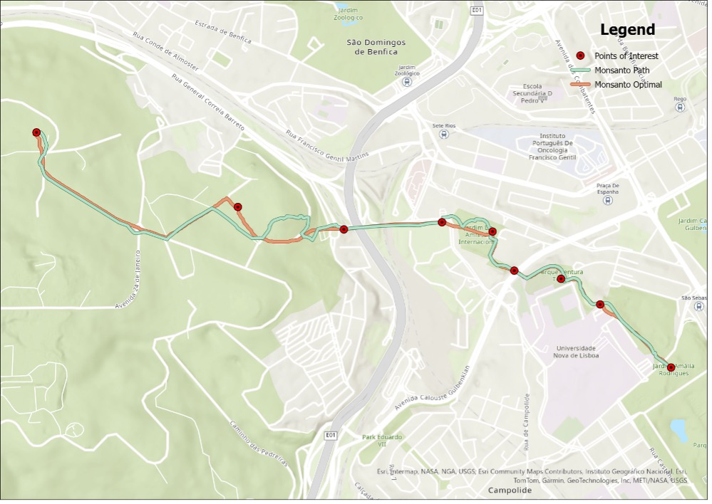
Ideal for eco-conscious tourists seeking respite from the heat while exploring Lisbon’s biodiversity and community spaces, this itinerary highlight the interplay between green infrastructure and urban amenities. By following this path, visitors can engage with local initiatives, admire public art, and discover hidden oases that enrich the city’s ecological resilience and social fabric.
This route is part of Lisbon’s biodiversity itinerary, promoting responsible tourism practices that benefit both visitors and residents:
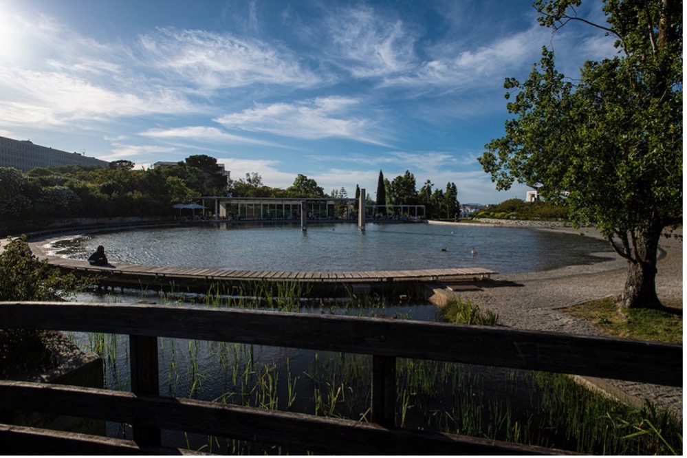
1. Amália Rodrigues Garden: Amália Rodrigues Garden is located just north of Parque Eduardo VII, in a central and elevated area of Lisbon, offering stunning panoramic views over the valley of Avenida da Liberdade. Named in 2000 in honor of the legendary fado singer, this green space is part of the Green Corridor that links Parque Eduardo VII to Monsanto Forest Park. The garden features a south-facing amphitheater-like lawn, an artificial lake, and lush landscaped areas ideal for relaxation. It is also home to notable sculptures, including Maternity by Colombian artist Fernando Botero and The Secret by Portuguese sculptor António Lagoa Henriques. Coordinates: 38.731161, -9.155161
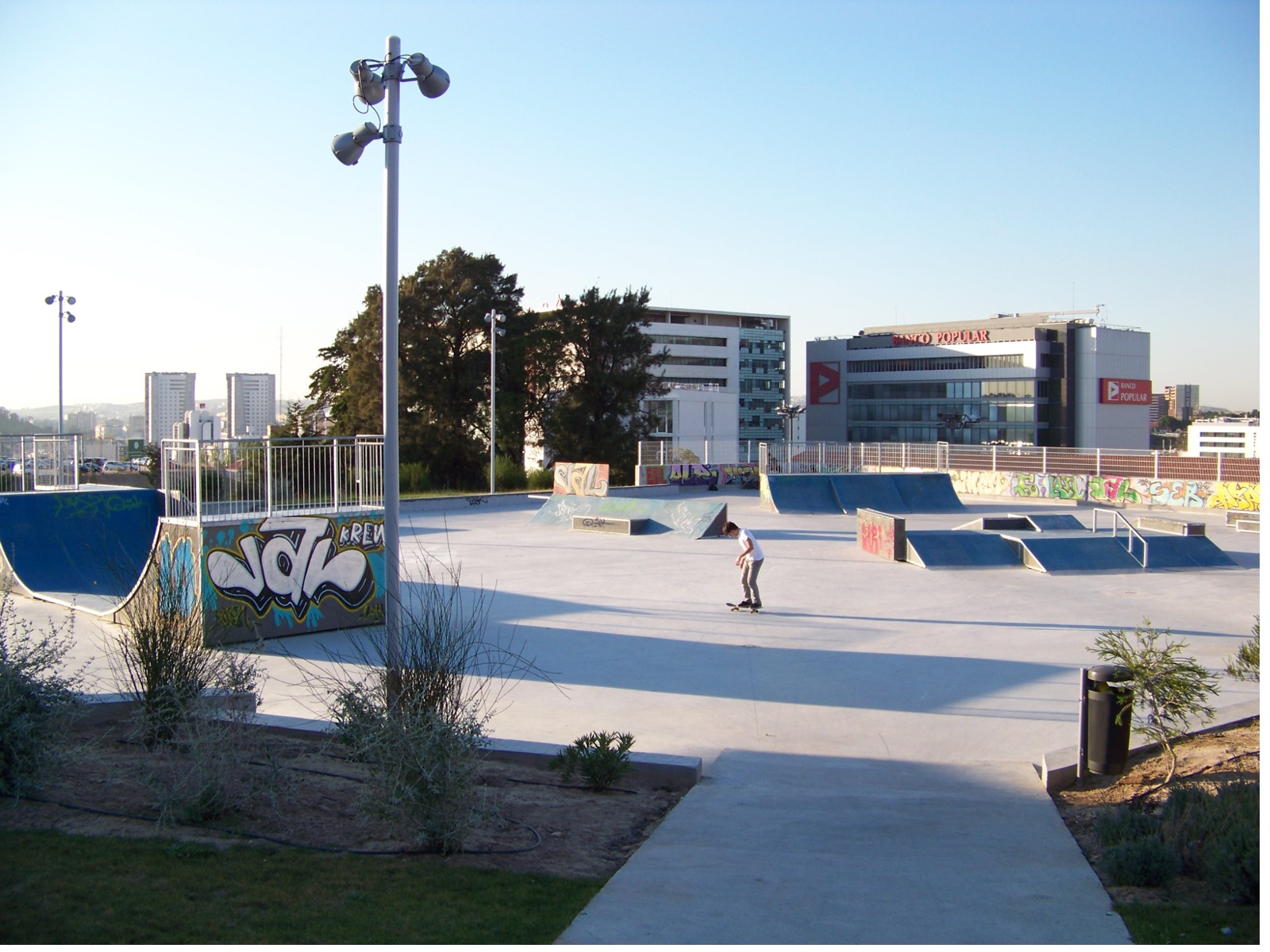
2. São Sebastião Skatepark: São Sebastião Skatepark is situated within Lisbon’s Green, near the Rectory of Universidade Nova de Lisboa, in a central and elevated area of the city. This location offers a unique blend of urban energy and natural surroundings. The skatepark is part of the Green Corridor that connects Parque Eduardo VII to Monsanto Forest Park. The park features a variety of modular obstacles. These structures are adorned with vibrant spray-painted artwork, infusing the area with a dynamic street-art atmosphere. Easily accessible via one of Lisbon’s many cycle paths, it serves as a creative and energetic stop for board sports enthusiasts. Coordinates: 38.731542, -9.154292
3. José Medeiros Ferreira Garden: Jardim José Medeiros Ferreira is in the Campolide district of Lisbon, nestled between the historic Águas Livres aqueduct and the Faculty of Law Library of Universidade Nova de Lisboa. This tranquil green space offers shaded walking paths, seating areas, and plantings that create cool microclimates, making it an ideal spot for relaxation and contemplation. Coordinates: 38.734668, -9.160936
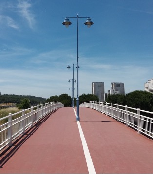
4. Gonçalo Ribeiro Telles Bridge: Ponte Gonçalo Ribeiro Telles is a pedestrian and cyclist bridge located in the Campolide district of Lisbon, near the Polícia Municipal Lisboa and adjacent to Jardim José Medeiros Ferreira. Named after the acclaimed landscape architect Gonçalo Ribeiro Telles, the bridge spans the valley near São Domingos de Benfica, offering scenic views of the historic Águas Livres Aqueduct. It serves as a seamless link in Lisbon’s Green Corridor network, connecting Parque Eduardo VII to Monsanto Forest Park. Coordinates: 38.734883, -9.162881
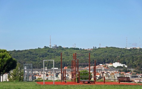
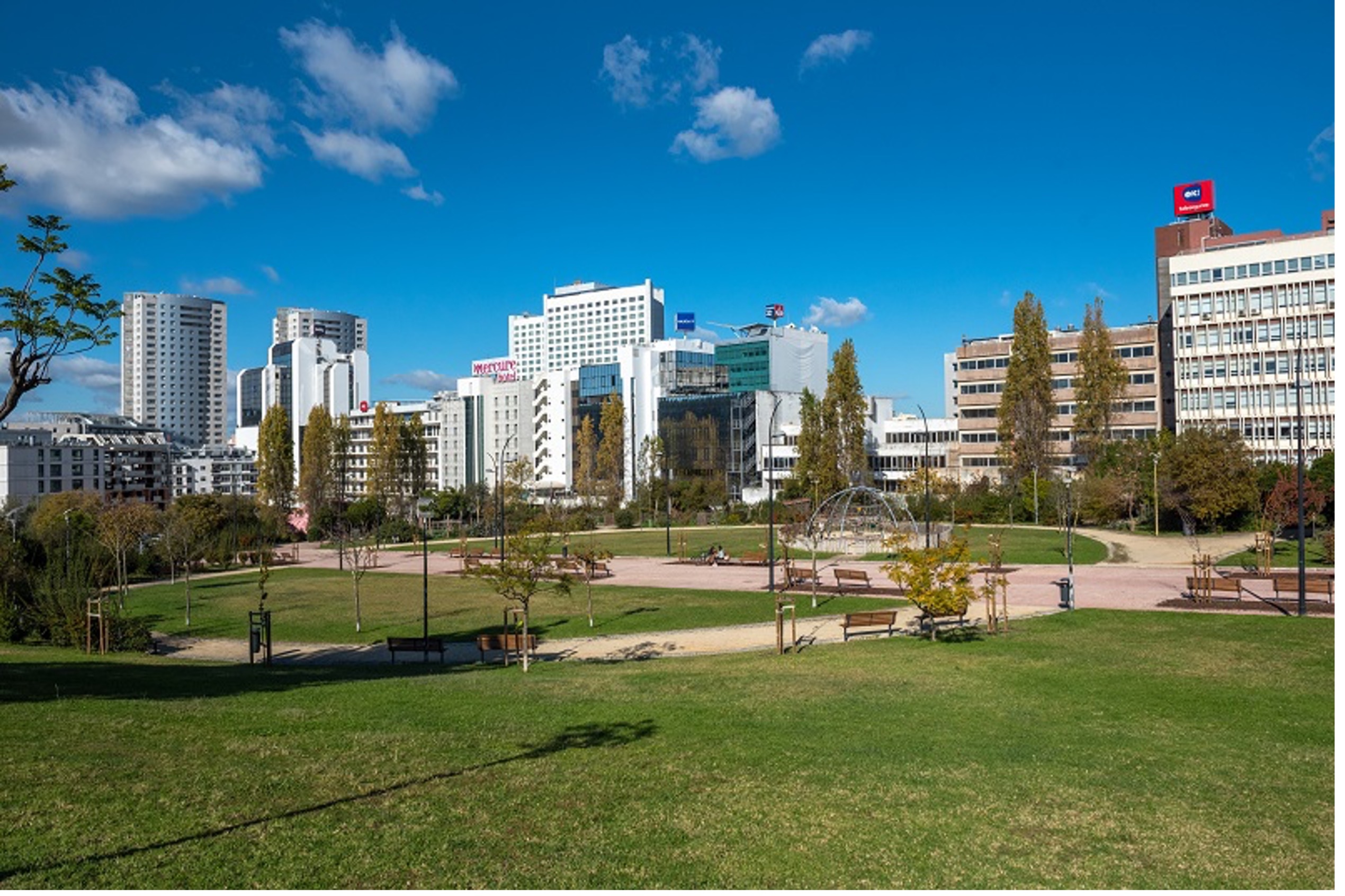
5. Amnistia Internacional Garden: Jardim da Amnistia Internacional is in the Campolide district of Lisbon, just behind the high-rise buildings of Avenida José Malhoa. This expansive 3.3-hectare green space was designed by renowned landscape architect Gonçalo Ribeiro Telles as part of the city’s Green Corridor, which connects Parque Eduardo VII to Monsanto Forest Park. The garden features a horticultural park promoting urban agriculture, a fitness area equipped with outdoor exercise stations, and a terraced lawn that serves as an open-air auditorium. These elements foster community engagement and environmental awareness, providing a tranquil retreat amidst the urban landscape. Coordinates: 38.736418, -9.164822
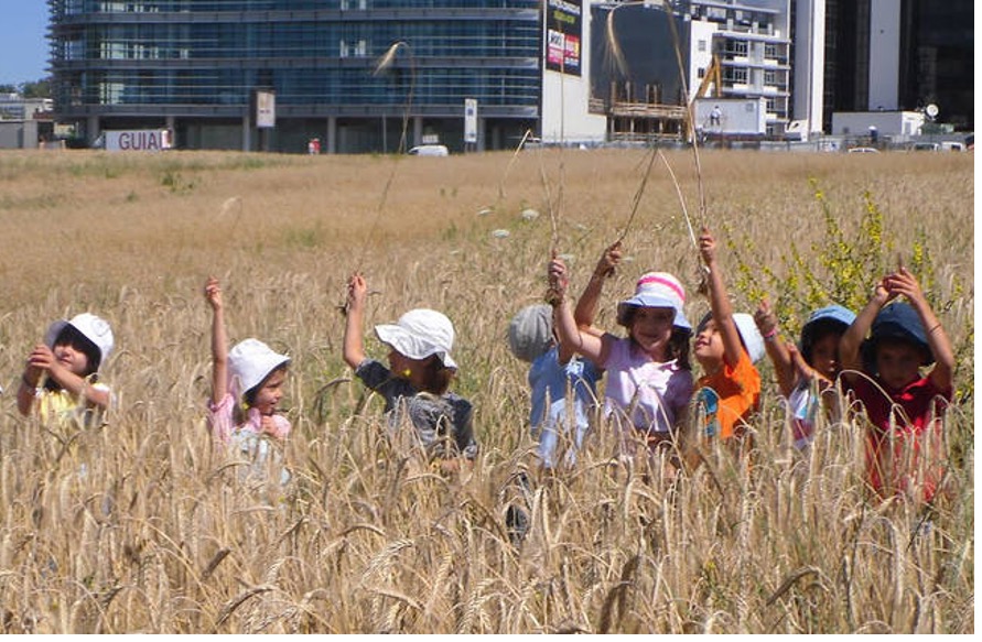
6. Quinta do Zé Pinto Urban Park: This park is located between Rua de Campolide and the railway lines, in a central area that blends urban life with natural landscapes. The park comprises two distinct zones: a leisure area featuring picnic spots, a children’s playground, and cycling trails, and an agricultural zone showcasing sustainable dryland farming practices. Wooded groves and native vegetation contribute to the park’s biodiversity and provide shaded areas for relaxation. Coordinates: 38.736760, -9.166468
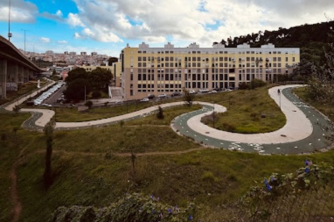
7. Snake Run Downhill Campolide: The steep downhill path descends beneath the Eixo Norte-Sul viaduct, offering an adrenaline-pumping experience for downhill cyclists and thrill-seekers. Its dynamic terrain and sharp gradients make it a popular spot for those seeking a high-energy ride. At the base of the descent lies the Campolide Skatepark, located directly under the Eixo Norte-Sul viaduct. This concrete skatepark, designed by Francisco Lopez, features a variety of ramps and obstacles, catering to skateboarders of different skill levels. The combination of the Snake Run and the adjacent skatepark creates a vibrant hub for urban sports within Lisbon’s Green Corridor. Coordinates: 38.736249, -9.171239
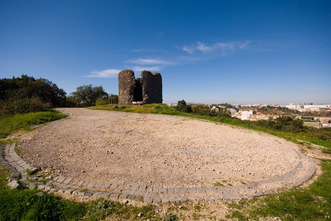
8. Viewpoint and Picnic Park of Parque Recreativo do Calhau: Parque Recreativo do Calhau is in the northeastern section of Lisbon’s Monsanto Forest Park, within the São Domingos de Benfica district. This expansive green space offers a variety of recreational amenities, including open clearings, a fitness circuit, and picnic shelters. The park’s natural setting, characterized by native vegetation and shaded areas, provides a tranquil environment for relaxation and outdoor activities. A notable feature of the park is the historic Moinho das Três Cruzes (Three Crosses Windmill), situated on a hilltop within the park. This windmill serves as a unique viewpoint, offering panoramic view over eastern Lisbon. Coordinates: 38.737777, -9.175415
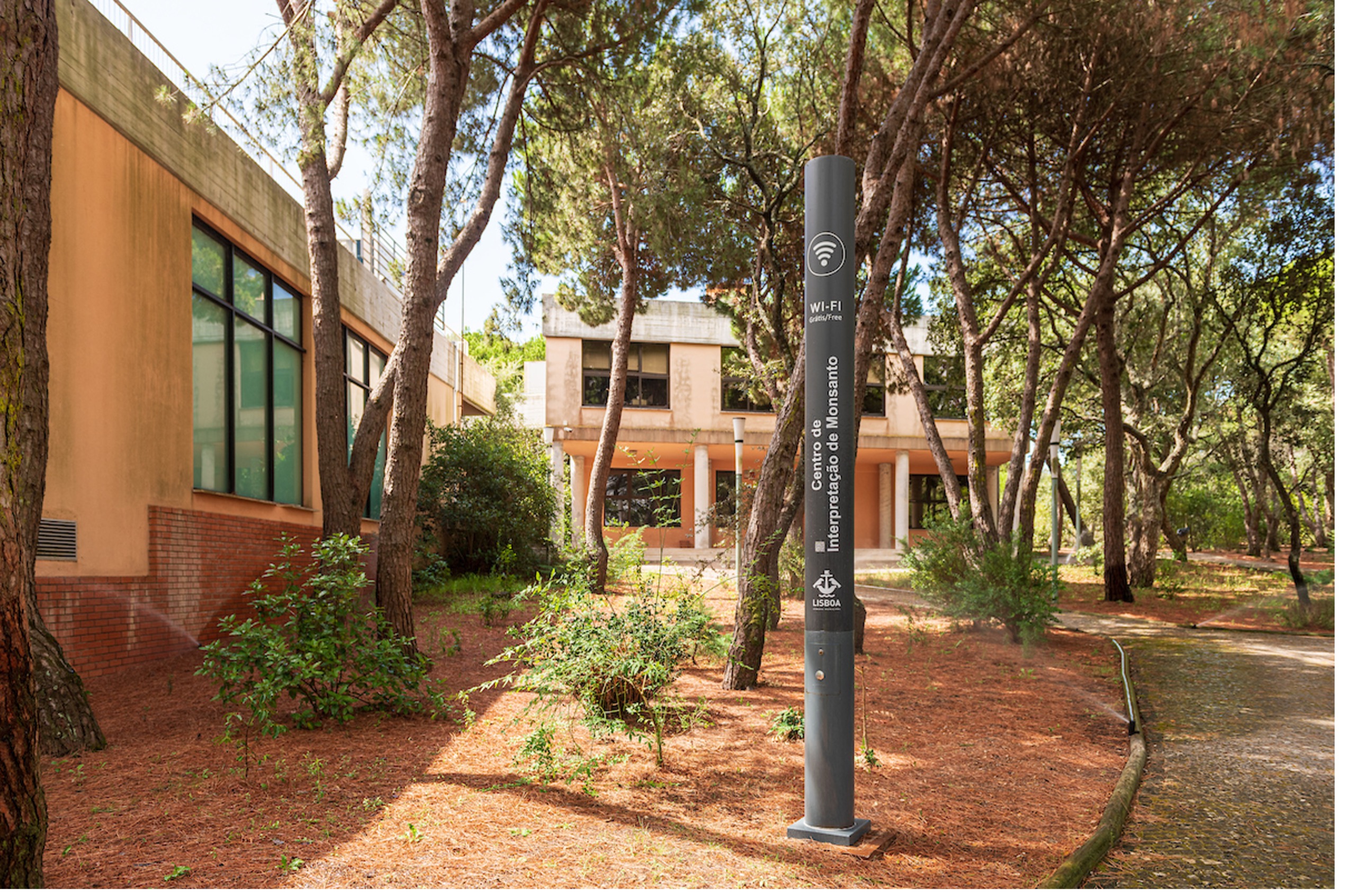
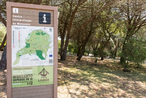
9. Monsanto Interpretation Centre (CIM): The Monsanto Interpretation Centre, also known as Espaço Monsanto, is the official gateway to Lisbon’s Monsanto Forest Park. Located on Estrada do Barcal in the Monte das Perdizes area, this multipurpose facility offers a comprehensive introduction to the park’s natural and cultural heritage.The center features an auditorium with seating for 144 people, exhibition areas, and the Biodiversity Space, which includes a 16-hectare protected forest area accessible through guided tours. Visitors can explore interpretive trails, a nature observation tower, an artificial lake simulating a wetland ecosystem, and a historic water mine. Additional facilities include a plant nursery, a phytoremediation wastewater treatment system, and the Wildlife Recovery Centre (CRAS), dedicated to the rehabilitation of injured wild animals. The center also provides picnic areas, a children’s playground, and restrooms, making it a family-friendly destination for environmental education and outdoor activities.
